TGS announced the start of the first phase of a comprehensive marine seismic data program in Equatorial Guinea after signing an agreement with the country’s Ministry of Hydrocarbons and Mining Development. The initiative envisions the creation of a multi-client marine MegaSurvey designed to enhance geological understanding of offshore basins and support future energy exploration activities.
First phase focused on the integration of seismic data
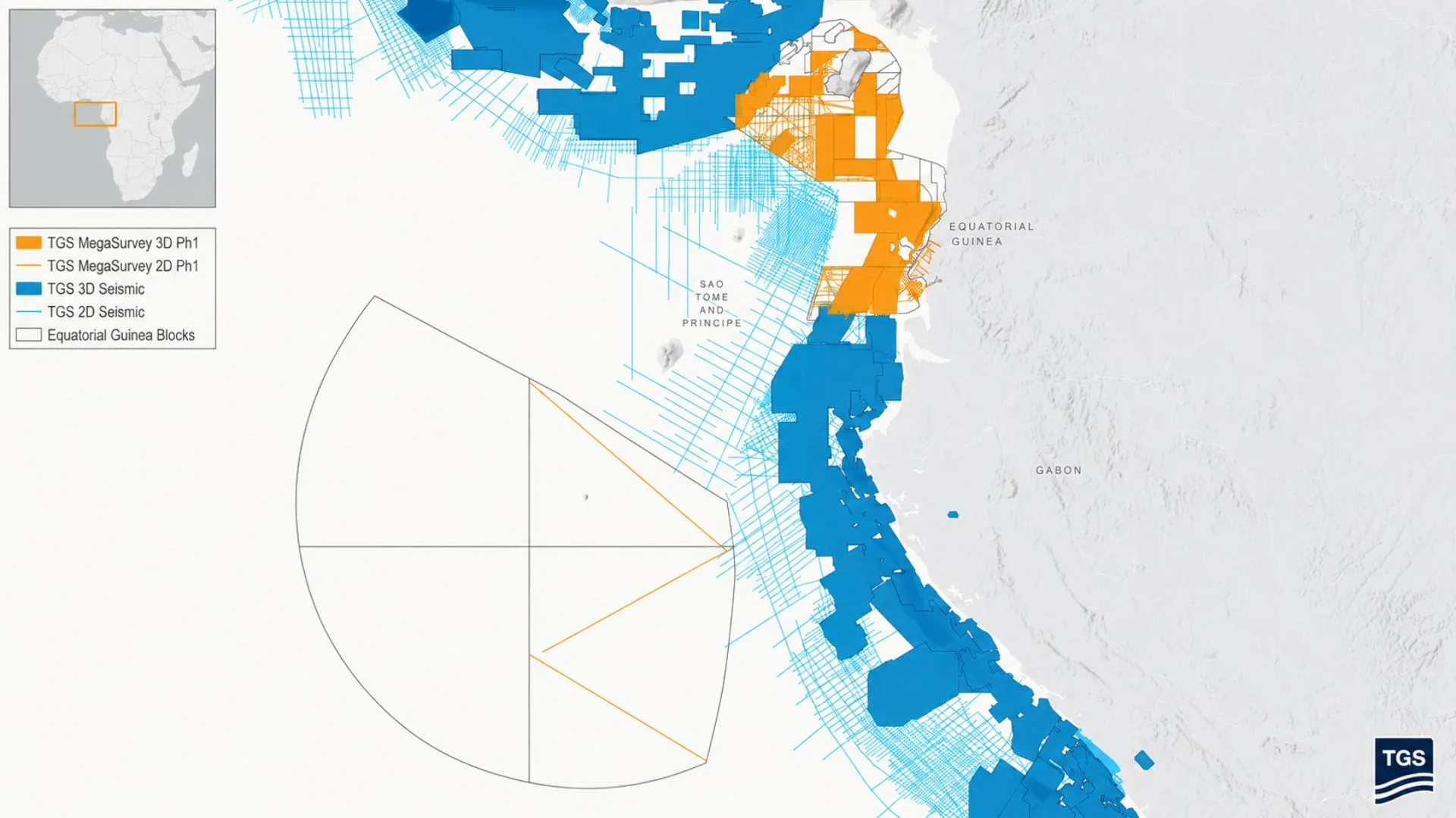
In this initial phase, the company will perform post-stacking reprocessing of approximately 27,273 kilometers of 2D seismic data and nearly 35,000 square kilometers of 3D seismic data. According to the planned schedule, the work will be completed during the third quarter of 2026.
Megaseismic projects involve the integration and harmonization of large volumes of geophysical data from various historical surveys. This approach allows for the generation of more consistent images of the subsurface and facilitates a more accurate geological interpretation.
Advanced technology to reduce exploration uncertainty
The company explained that the MegaSurvey will apply its latest seismic processing and imaging technologies to address complex challenges related to subsurface characterization.
David Hajovsky, TGS’s Executive Vice President of Multiclient Services, noted that the project will improve the regional assessment of the Río del Rey and Río Muni basins. He also emphasized that the tool will facilitate the identification of prospects and the planning of future exploration campaigns.
Thanks to the integration of historical datasets within a coherent regional framework, operators will be able to have a more complete view of the geological structures and petroleum systems present in the marine areas of Equatorial Guinea.
A project with national reach and regional vision
The agreement represents the first phase of a broader strategy to build a harmonized seismic product that covers all of the country’s marine basins.
Once completed, the dataset will include approximately 46,343 linear kilometers of 2D seismic information and more than 59,000 square kilometers of 3D seismic data, becoming one of the most extensive geophysical resources available for offshore exploration in the region.
Likewise, the initiative aligns with TGS’s strategy to develop integrated regional products in the Gulf of Guinea, an area where sedimentary basins extend beyond national borders and require regional-scale interpretive approaches.
The offshore potential of the basins of Equatorial Guinea
The availability of updated and harmonized seismic data will allow energy companies to make more accurate assessments of the exploratory potential of the marine basins of Equatorial Guinea.
With a better understanding of stratigraphic frameworks and subsurface structures, the project seeks to contribute to informed decision-making and the reduction of risks associated with future investments in oil and gas exploration in the region.
Source and photo: Tgs