Satellites do not directly inspect the buried pipeline; they observe the right-of-way and the environmental changes that can compromise it.
A pipeline can complete an inspection without apparent anomalies and, a few hours later, be exposed to unauthorized excavation, an erosive flood, or a hillside accelerating its displacement. Vulnerability arises from the gap between periodic patrols, especially in extensive, remote, or restricted-access corridors.
The key question is: What does a ground inspection fail to detect? It may fail to detect threats that appear between inspection runs, activities hidden by vegetation, slow ground movements, or changes located outside the inspector’s field of view. Satellite monitoring of pipelines complements this coverage through repeated, comparable, and georeferenced observations, provided that the operator can convert the detected anomaly into a field verification and an integrity decision.
Limitations of ground inspection of the right-of-way
Ground pipeline inspection: partial vision
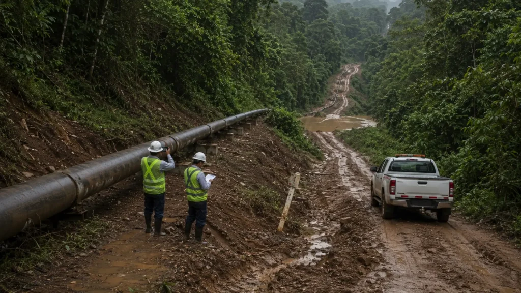
Ground pipeline inspection remains indispensable for identifying exposed piping, damaged markers, localized erosion, heavy machinery, irregular occupations, and changes at water crossings. It also allows verifying permits, evaluating visible conditions, and observing details that a remote image cannot always resolve.
The restriction appears when the right-of-way crosses forests, floodplains, hillsides, or properties with controlled access. The inspector records the visible portion during a given time window; vegetation, relief, lighting, and weather conditions can reduce effective coverage.
In operational terms, ground inspection may not detect changes occurring between patrols, activities hidden by vegetation, slow ground movements, or alterations located outside the inspector’s field of vision. It also offers limited ability to objectively compare the evolution of an anomaly over time.
In the United States, 49 CFR 192.705 requires patrol programs to observe indications of leaks, construction activities, ground movement, and other factors that may affect transmission pipelines.
For hazardous liquid and carbon dioxide pipelines, 49 CFR 195.412 establishes inspections of the surface conditions of the right-of-way with a maximum frequency of three weeks and at least 26 times per year. These provisions set regulatory intervals but do not generate continuous observation.
Historical comparison can also lose precision. Photographs taken from different angles, incomplete descriptions, or imprecise coordinates make it difficult to determine whether an anomaly grew, shifted, or remained stable.
Industrial pipelines under changing threats
The right-of-way constitutes a dynamic interface between geology, climate, human activity, and operation. Visual observation recognizes surface manifestations, although it does not inherently quantify the speed of a hillside, the extent of a subsidence, or its evolution between inspections.
A small displacement does not automatically represent a failure condition. Its acceleration, direction, and extent determine the potential to induce bending, ovalization, or axial loads, considering soil properties, burial depth, and soil-pipe interaction.
The accident in Satartia, Mississippi, evidences the severity of these threats. On February 22, 2020, a carbon dioxide pipeline ruptured after heavy rains caused a landslide that imposed excessive axial deformation on a girth weld. The event forced the evacuation of approximately 200 residents, and 45 people were transported to the hospital.
PHMSA also pointed out the lack of adequate routine inspections of the right-of-way as a probable non-compliance. According to the agency, more consistent surveillance would have allowed the operator to better understand the environmental conditions that could compromise pipeline safety.
The case does not prove that a satellite image would have prevented the rupture. It confirms that the operator needs to combine right-of-way inspections, rainfall records, geotechnical analyses, and repetitive ground observations to recognize trends before movement imposes an unacceptable mechanical demand.
What satellite monitoring detects in pipelines
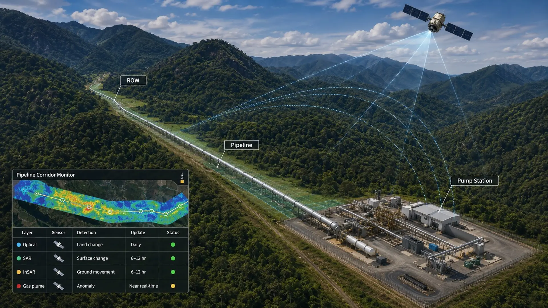
Mainly, changes in the surface environment of the asset: excavations, new roads, constructions, right-of-way encroachments, vegetation alterations, floods, erosion, and soil removal.
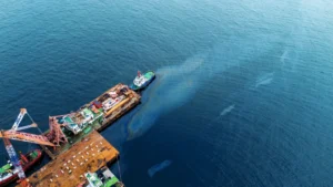
Satellite imagery for pipelines also allows comparing different dates to identify subsidence, landslides, and historical modifications of the corridor. Some specialized sensors can recognize large gas plumes or surface indications of spills, although they do not reliably detect all small leaks.
Remote monitoring, therefore, does not directly determine the thickness, corrosion, cracks, or wall deformation of a buried pipeline. Its function is to recognize external changes that can originate or increase an integrity threat.
Satellite imagery for pipelines: optics and radar
Multispectral optical images can reveal constructions, road openings, trenches, soil removal, vegetation loss, floods, erosion, and land use changes. They also allow identifying modifications at river crossings, urban expansion, and occupations that increase exposure to third-party damage.
The Sentinel-2 mission features 13 spectral bands, a spatial resolution of up to 10 meters, and a nominal revisit time of five days. These capabilities allow observing regional changes, but they may be insufficient to confirm a narrow trench or small machinery located near the pipeline centerline.
In those cases, higher-resolution commercial images, unmanned aerial systems, or ground inspection are required. The orbital frequency also does not guarantee that the information is usable: clouds, shadows, smoke, and lighting conditions can invalidate an optical acquisition.
Synthetic Aperture Radar (SAR) acquires information during day or night and can observe the surface through clouds. Its signal allows recognizing variations associated with flooding, moisture, roughness, or soil removal.
However, agricultural tillage, recent rains, and authorized traffic also modify the radar backscatter. Interpretation must consider the surface type, permitted activities, meteorological records, and the operational context to avoid false positives.
Monitoring the right-of-way with InSAR
Interferometric Synthetic Aperture Radar (InSAR) compares acquisitions made over the same area to estimate ground displacements in the satellite’s line of sight. In pipeline corridors, it allows delimiting subsidence, slow landslides, and slope instability.
Time series allow differentiating stable ground, sustained displacement, and progressive acceleration. Under favorable conditions, InSAR is sensitive enough to recognize small movements over large areas; this capability does not equate to a direct measurement of the pipeline’s mechanical deformation.
The response of the asset depends on the burial depth, the three-dimensional geometry of the movement, soil properties, diameter, thickness, material grade, and weld condition.
Dense vegetation, rapid surface changes, and an unfavorable orbital geometry can reduce interferometric coherence. Therefore, an anomaly must be verified through field inspection, surveys with Global Navigation Satellite Systems (GNSS), inclinometers, geotechnical studies, and soil-pipe interaction models.
Some atmospheric sensors can also identify significant plumes of methane or other gases, while certain optical or spectral products can show surface alterations compatible with spills. The capability depends on the flow rate, wind, cloud cover, reflectance, resolution, and revisit frequency. The absence of a satellite signal does not rule out a leak.
| Technology | Observable changes | Advantage | Limitation |
| Optics | Constructions, roads, vegetation, and erosion | Visual and historical comparison | Clouds, shadows, smoke, and darkness |
| SAR | Flooding, moisture, roughness, and soil removal | Operates day, night, and with cloud cover | Requires controlling false positives |
| InSAR | Subsidence, landslides, and ground displacement | Analyzes trends and acceleration | Depends on coherence and geometry |
| Atmospheric sensors | Gas plumes or major spill signatures | Coverage of remote areas | Limited sensitivity for small emissions |
Integration of satellite alerts and ground inspection
The technology generates value when it reduces the interval between the appearance of a change, its analysis, and the response. A map with numerous polygons lacks operational utility if the alerts do not have a priority, responsible party, verification deadline, and closure criteria.
The most effective architecture integrates satellite constellations, ground sensors, and operational records. The operator must measure the revisit time, the availability of a usable acquisition, analytical processing, and personnel mobilization separately.
A platform may observe a corridor with high frequency and deliver the alert too late to control an active excavation. Real performance does not depend solely on how many images are captured, but on how long it takes the organization to convert them into actions.
From image to an actionable alert
The flow starts with a geospatial baseline that includes the pipeline centerline, right-of-way width, crossings, valves, slopes, unstable terrain, and history of third-party damages. High consequence areas (HCAs) must also be incorporated, because the potential consequence modifies the priority of the same anomaly.
The operator selects the sensor based on the threat:
- Optical images for constructions, roads, excavations, and surface alterations.
- SAR for flooding, moisture, and roughness changes.
- InSAR for ground displacements and deformation trends.
- Atmospheric sensors for emissions within their detection thresholds.
The calculated distance between an anomaly and the centerline loses value when the cartography or georeferencing has uncertainty. The analysis must combine the positional error of the pipeline, the geometric accuracy of the product, and the minimum detectable size.
Alerts are classified according to their confidence level, proximity to the centerline, rate of change, and potential consequence. They must be cross-referenced with work permits, One Call/811 tickets, meteorological information, Supervisory Control and Data Acquisition (SCADA) variables, leak detection systems, in-line inspection, cathodic protection, and the segment’s history.
These sources are complementary and do not necessarily come from a single platform. Operational variables may be available in SCADA, while in-line inspection results, cathodic protection, permits, and excavation notices belong to specialized systems.
From anomaly to integrity decision
If an optical comparison detects an open road over the right-of-way without authorized work, the operator must verify the activity, locate the pipeline, and determine whether excavation, excessive surface loading, or mechanical contact occurred. The image identifies the change but does not itself confirm the existence of damage.
If InSAR records the acceleration of a hillside after heavy rains and the segment coincides with an HCA, the alert must be integrated with geotechnical inspection, GNSS measurements, inclinometers, and soil-pipe interaction models.
Depending on the results, measures may include increasing observation frequency, installing instrumentation, improving drainage, controlling erosion, stabilizing the slope, evaluating stresses, temporarily reducing pressure, or relocating the segment.
Any excavation over a pipeline subjected to ground movement requires specific geotechnical and mechanical planning. The removal of soil confinement can modify the acting loads and should not be executed as a routine intervention.
The satellite prioritizes the site and engineering determines the action. Ground inspection confirms the sensor’s inferences and feeds back into the analytical system. Every validated or discarded alert allows adjusting thresholds, reducing false positives, and identifying conditions that the algorithm does not yet recognize.
Geospatial monitoring and regulatory compliance
PHMSA regulation
US regulation is moving toward a technologically neutral approach. In 2025, PHMSA published a direct final rule aimed at recognizing remote technologies for right-of-way patrolling, but subsequently withdrew the measure after receiving adverse comments.
On April 24, 2026, PHMSA published a new proposed rule on remote sensing technologies. The document clarifies that operators can employ unmanned aerial systems, satellites, and other technologies to meet the patrol requirements for natural gas, hazardous liquid, and carbon dioxide pipelines. As of July 2026, it remains classified as a proposal and not as a final rule.
The proposal expands the alternatives for right-of-way monitoring, but it does not make any image sufficient evidence. The operator must select a suitable method for foreseeable threats, use recent information, analyze it in a timely manner, and document its limitations.
A product whose resolution does not allow recognizing the sought condition could be inadequate to demonstrate program performance. The responsibility to justify the method, establish response criteria, and retain evidence remains with the operator.
Auditable evidence and performance
A defensible program must retain the acquisition date, sensor, resolution, effective coverage, conditions that degraded the image, algorithm version, applied thresholds, person responsible for the analysis, generated alerts, field verification, and closure.
The most useful indicators include:
- Percentage of the corridor with valid coverage.
- Time from acquisition to analysis.
- Time from alert to verification.
- Percentage of confirmed alerts.
- Segments without usable data.
- Recurrent anomalies.
- Events detected by other means that the system missed.
The program can be integrated with API RP 1160, aimed at managing the integrity of hazardous liquid pipelines, and API RP 1173, applicable to pipeline safety management systems.
For geotechnical and hydrotechnical threats, API RP 1187, on landslide hazards, and API RP 1133, related to floods, erosion, and water crossings, are also relevant. These practices provide management frameworks; their mandatory nature depends on the regulation, contract, or policy of the operator that incorporates them.
Conclusions
Satellite pipeline monitoring provides information to expand right-of-way coverage, compare conditions over time, and prioritize threats on industrial pipelines located in extensive or remote corridors.
The answer to what does ground inspection not detect? It encompasses activities occurring between patrols, gradual movements requiring time series, alterations hidden by vegetation, and changes located outside the effective coverage of the inspector.
The most robust strategy employs satellites to detect and prioritize, ground inspection to confirm, and integrity analysis to decide. Satellite monitoring does not replace the inspector, the geotechnical specialist, the controller, or the internal evaluation tools; it strengthens their capacity to intervene with broader and more timely information.
The technical advance consists of reducing the time between the appearance of a threat and a documented response. When detection, validation, and closure are integrated with management systems, surveillance evolves into operational intelligence to protect the continuity of the pipeline, communities, and the environment.
References
- American Petroleum Institute. (2019). Managing system integrity for hazardous liquid pipelines (API Recommended Practice 1160, 3rd ed.). API Publishing Services.
- American Society of Mechanical Engineers. (2022). Managing system integrity of gas pipelines (ASME B31.8S-2022). ASME.
- Pipeline and Hazardous Materials Safety Administration. (2023). Transportation of natural and other gas by pipeline: Minimum federal safety standards (Title 49, Code of Federal Regulations, Part 192). U.S. Government Publishing Office.
- Wasowski, J., & Bovenga, F. (2014). Investigating landslides and unstable slopes with satellite multi temporal interferometry: Current issues and future perspectives. Engineering Geology, 174, 103–138. https://doi.org/10.1016/j.enggeo.2014.03.003