Table of Contents
- Why do terminals lose operational draft?
- Bathymetric survey: knowing how much draft has been lost
- Port maintenance dredging: From bathymetry to intervention
- Waves, currents, and sediment transport: Will draft be lost again?
- Recovering operational draft requires more than dredging
- Conclusions
- References
- Frequently asked questions about maintenance dredging
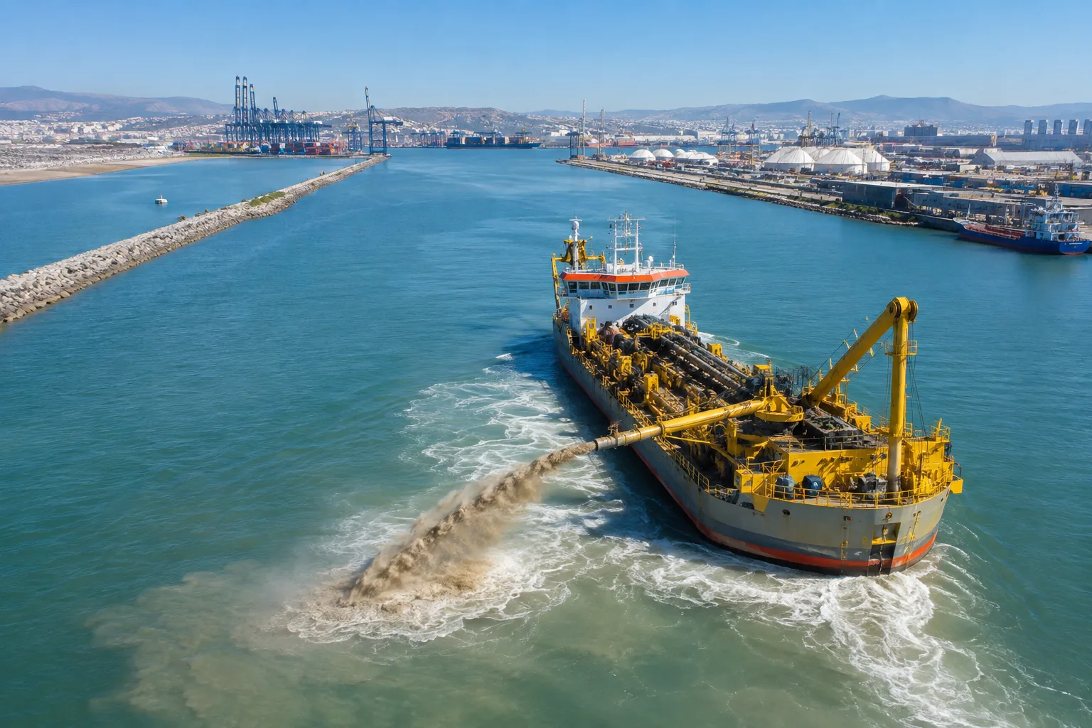
Maintenance dredging is a fundamental intervention to recover operational depth when the progressive accumulation of sediment begins to reduce the available draft in navigation channels, basins, and berthing areas. The progressive loss of depth in navigation channels, basins, and berthing areas can become a critical limitation for the operation of a maritime terminal, even when its loading systems, pipelines, arms, fenders, and other infrastructure remain available. The accumulation of sediment modifies seabed conditions and reduces the margin available for navigation, making it necessary to resort to maintenance dredging to restore required depths and preserve safe operational conditions.
As available draft decreases, restrictions may be established for certain vessels, operational windows reduced, and transported cargo volumes limited. In more restrictive scenarios, maneuvers may become conditional on the tide, while the safety margin under the keel decreases and the risk of grounding increases. The consequence can be a progressive reduction in the availability and operational capacity of the terminal.
However, recovering depth is not merely a matter of mobilizing a dredge and removing sediment. Before intervening, it is necessary to understand the magnitude, distribution, and dynamics of the accumulated material. A fundamental question then arises: how to determine how much material must be removed, where to dredge, and what conditions must be evaluated to safely and sustainably recover a terminal’s operational draft?
Why do terminals lose operational draft?
The loss of operational draft is the result of a continuous hydrodynamic process in which sediments are transported, deposited, and redistributed across the seabed. In maritime terminals, access channels, and maneuvering areas, this phenomenon gradually modifies the depth available for navigation and can compromise the capacity to receive vessels with the design draft. Understanding the mechanisms that cause sedimentation is the first step toward planning technically justified and sustainable interventions.
Sedimentation in channels and maneuvering areas
Sediments reach terminals through multiple sources and natural processes. Fluvial input transports sand, silt, and clay from river basins, while littoral transport redistributes material along the coast under the action of waves and currents, joined by variations produced by tides, which modify circulation patterns and favor deposition in low-energy areas.
Sediment grain size determines its behavior: fine particles remain suspended longer, while coarser materials tend to settle more rapidly. Likewise, channel geometry, terminal orientation, breakwaters, piers, and basins alter the natural flow of water, creating areas where sediment resuspension and redeposition predominate. As a result, the seabed constantly evolves and loses the configuration for which it was designed.
From sedimentation to an operational restriction
The impact on operations follows a clearly identifiable sequence: sedimentation → depth reduction → loss of available draft → operational restrictions → need for intervention. As navigable depth decreases, vessels may be forced to reduce their cargo, operate only during certain tides, or limit the access of larger vessels. More than an infrastructure problem, the loss of draft represents a direct decrease in logistical capacity and terminal operational reliability, making a technical evaluation essential to determine when and where to intervene.
Bathymetric survey: knowing how much draft has been lost
Before defining a dredging campaign, it is necessary to precisely know the current geometry of the seabed and determine how much it has changed relative to the depths required for operation. Bathymetric surveying provides this information and constitutes a fundamental tool to transform observed draft loss into measurable data to support intervention decisions.
Bathymetry and identification of critical areas
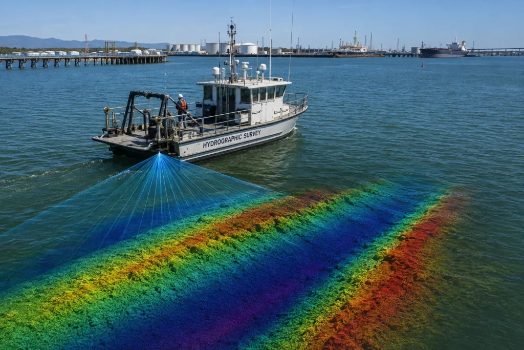
Hydrographic surveys allow determining existing depths and representing seabed configuration in navigation channels, basins, maneuvering areas, and berthing zones. Depending on the size, resolution, and characteristics of the area, single-beam or multibeam echosounders can be used, integrated with GNSS systems and hydrographic acquisition and processing tools.
The information obtained allows identifying shallow areas, irregularities, and preferential sediment accumulation zones. By comparing the surveyed bathymetric surface with design levels or required operational depths, it is possible to delineate sectors where depth loss has occurred and establish the true extent of areas requiring intervention.
From hydrographic survey to dredging volume
Detecting sedimentation is not enough to technically plan maintenance dredging. It is necessary to determine its spatial distribution and quantify the material that must be removed to recover the required geometry.
Comparing the current seabed surface with the target surface makes it possible to estimate dredging volumes by sector, identify priority areas, and reduce unnecessary interventions. This quantification serves as an essential foundation for defining the scope of work, selecting the dredging strategy, and estimating resources, time, and costs. Furthermore, post-intervention bathymetry allows verifying that required depths have indeed been recovered.
Port maintenance dredging: From bathymetry to intervention
Once areas where sedimentation has reduced available depth are identified, bathymetric information must be converted into concrete intervention criteria. At this point, it is important to differentiate capital dredging, intended to create new navigable areas or increase existing depths, from maintenance dredging, whose objective is to recover a previously established depth lost progressively through sediment accumulation.
How much and where to dredge?
Planning must begin by comparing existing depth with target depth required for safe terminal operation. However, defining the surface to be dredged must also consider channel geometry, basins, maneuvering areas, and berthing zones, as well as execution tolerances and criteria established for each sector.
Deficit areas can be delineated and sediment volumes to be removed estimated from the bathymetric model. This information allows establishing priorities, sizing the intervention, and avoiding both insufficient removal and unnecessary dredging of sectors that retain adequate depth conditions.
Sediment must also be characterized
Volume is not the only parameter determining how to execute dredging. Material properties influence its excavability, behavior during extraction and transport, equipment selection, and disposal options.
Characterization may include grain size, density, and other relevant physical properties. When environmental conditions, terminal history, or regulatory requirements justify it, evaluating the presence of contaminants may also be necessary. This information helps determine whether sediments can be disposed of in authorized areas, require specific handling, or offer potential for beneficial reuse.
Therefore, a technically sound port maintenance dredging strategy integrates bathymetry, operational geometry, volume, and sediment characteristics before defining how to execute the intervention.
Waves, currents, and sediment transport: Will draft be lost again?
Dredging removes accumulated sediment and recovers required depth, but it does not necessarily eliminate the processes that caused deposition. If hydrodynamic conditions continue transporting material into the channel, basin, or berthing areas, the seabed may begin modifying again after the intervention. Understanding this dynamic is crucial to anticipating resedimentation and managing operational draft over the long term.
Hydrodynamic modeling
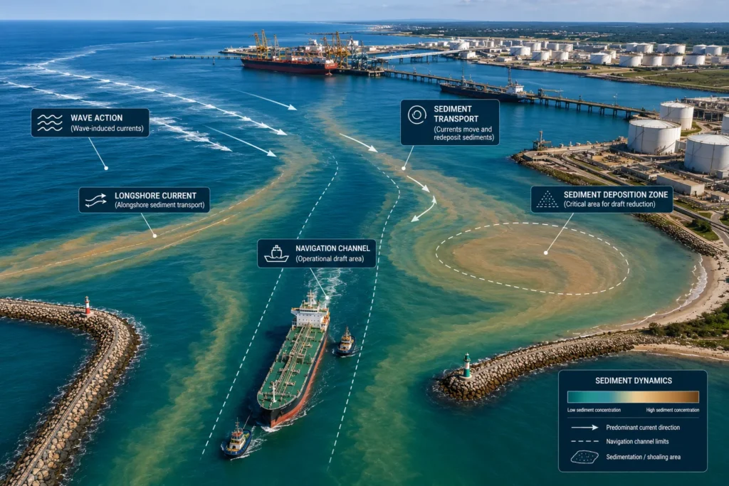
Waves, currents, tides, and local circulation patterns control, to varying degrees, the environment’s ability to erode, transport, and deposit sediment. Their behavior can vary temporally and spatially, and be modified by coastal geometry and infrastructure such as breakwaters, piers, and channels.
Hydrodynamic modeling allows representing these processes and analyzing how flows behave under different conditions. This information helps identify sectors where flow velocities favor material mobilization and others where energy reduction facilitates deposition.
Sediment transport and redeposition
By integrating hydrodynamic conditions with sediment characteristics, transport models allow studying potential material sources, predominant movement routes, and preferential accumulation areas.
This analysis can also contribute to estimating resedimentation potential and evaluating trends that condition the future frequency of maintenance dredging. Comparing successive bathymetric campaigns complements these models by showing how the seabed actually evolves over time.
In this way, management ceases to be exclusively reactive. Recovering depth is an intervention; understanding why it is lost is a terminal management strategy.
Recovering operational draft requires more than dredging
Sustainable recovery of operational draft requires integrating measurement, analysis, and engineering before and after the intervention. The process begins with a hydrographic survey, from which bathymetry allows representing the current seabed geometry and identifying areas where sedimentation has reduced available depth.
These results can be complemented by evaluating waves, currents, and tides, as well as analyzing sediment transport, to understand the mechanisms that favor mobilization and redeposition. With this information, it is possible to define maintenance dredging needs with greater justification, delineate intervention areas, and estimate volumes to be removed.
The technical sequence can be summarized as: hydrographic survey → bathymetry → identification of sedimentation → wave and current modeling → sediment transport analysis → definition of dredging needs → execution → verification bathymetry → recovery of operational draft.
Once dredging is executed, the verification survey allows checking achieved depths against requirements established for operation.
This integrated approach is part of the capabilities developed by specialized maritime engineering companies such as Grupo HB, which combines bathymetric surveys, wave and current modeling, sediment transport analysis, evaluation of dredging needs, and maritime engineering to support the recovery of operational depth in channels and terminals.
Draft management thus ceases to be an isolated response to sedimentation and becomes a technical process supported by measuring, understanding, intervening, and verifying.
Applying this approach requires integrating knowledge of the maritime environment, specialized engineering, and operational experience. In the following Inspenet TV program, Rodrigo González, president of Grupo HB, addresses the company’s experience in maritime engineering, port infrastructure, and offshore projects.

Conclusions
Loss of draft is not a static condition. Sedimentation processes, currents, waves, tides, and seabed modifications continue acting after each intervention. Therefore, recovering depth in a channel or terminal should not be understood as an isolated action, but as part of an ongoing strategy for managing navigable depth.
This approach implies evolving from a reactive model—detecting depth loss and dredging—toward an information-supported sequence: measure → analyze → model → intervene → verify → monitor. Periodic hydrographic surveys allow tracking seabed evolution, while hydrodynamic and sediment transport analysis provides information to understand where accumulations occur, how they evolve, and when they might affect operations again.
Integrating these elements allows planning maintenance dredging with greater technical grounding, prioritizing critical areas, and anticipating future intervention needs, contributing to preserving terminal safety and availability.
Ultimately, maintenance dredging recovers depth; maritime engineering allows understanding why it is lost and how to preserve it.
References
- International Hydrographic Organization (IHO/OHI). S-44 – Standards for Hydrographic Surveys.
- NOAA – Hydrographic Surveying.
- PIANC – Dredged Material as a Resource.
- U.S. Army Corps of Engineers – EM 1110-2-5025, Dredging and Dredged Material Management.
Frequently asked questions about maintenance dredging
How often should maintenance dredging be performed?
There is no universal frequency. The frequency depends on the sedimentation rate, hydrodynamic conditions, sediment characteristics, maritime traffic, required depth, and operational tolerance of the terminal. Monitoring through periodic bathymetric campaigns allows determining when depth loss begins to justify a new intervention.
What is the difference between channel depth and vessel draft?
Depth corresponds to the available vertical distance between a reference water level and the seabed, while draft represents the distance between the waterline and the lowest submerged point of the vessel. For safe navigation, an adequate under-keel clearance and dynamic conditions that may modify it must also be considered.
Can material extracted during port dredging be reused?
In certain projects, yes. Depending on its physical, chemical, and environmental characteristics, dredged material can be evaluated for beneficial uses such as beach nourishment, environmental restoration, land reclamation, or specific engineering applications. Its feasibility depends on sediment characterization and applicable regulatory requirements.
What happens if a terminal excessively postpones maintenance dredging?
Progressive sedimentation can reduce the margin available for navigation and force draft, cargo, or access window restrictions to be established. If available depth ceases to satisfy established operational requirements, the terminal’s capacity to receive certain vessels may be limited.
Should bathymetry be repeated after dredging?
Yes. A subsequent survey allows verifying the achieved geometry, identifying sectors that still present deficits, and checking compliance with the depths and tolerances defined for the intervention. It also provides a new baseline for future monitoring campaigns.