The Airbus-built EarthCARE weather observation satellite has been successfully launched from Vandenberg Army Base in California. EarthCARE (Earth Cloud Aerosol and Radiation Explorer) is a joint effort of the European and Japanese space agencies, ESA and JAXA. This satellite will analyze how clouds and aerosols (tiny particles in the atmosphere) influence the balance of solar and terrestrial radiation, examining their role in both cooling and heating the atmosphere.
What is the purpose of the EarthCARE satellite?
The EarthCARE satellite represents the largest and most complex mission of ESA’s Earth Explorer program.“It is a flagship mission that will improve the accuracy and reliability of climate and weather prediction models,” noted Alain Fauré, Airbus space systems director.
EarthCARE will provide detailed vertical profiles of natural and anthropogenic aerosols. anthropogenic aerosols and will measure the distribution and movement of water droplets and ice crystals in clouds. These data are essential for improving global warming models and weather forecasts. Aerosols play a crucial role in the life cycle of clouds and affect how these emit radiation and so their measurement is vital for a better understanding of the Earth’s energy budget.
In addition, the satellite has a broadband radiometer developed by ESA through European industry, a multispectral imager from Surrey Satellite Technology Limited and a cloud profiling radar from JAXA. This unique combination of instruments will allow scientists, for the first time, to directly assess the role of clouds and aerosols in the Earth’s radiation budget with an integrated satellite system, thus reducing current uncertainties. The following video from the European Space Agency (ESA) shows the moment of its launch.

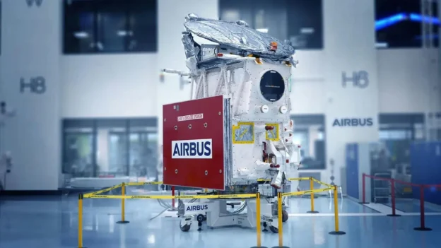
The satellite represents the largest and most complex mission of ESA’s Earth Explorer program. Source: ESA
International collaborations
With regard to international cooperation, the aircraft was developed, built and tested with the participation of experts from 15 European countries, as well as from Japan and Canada, under the direction of Airbus in Friedrichshafen, Germany. One of the four instruments on board is the Airbus-built ATLID atmospheric lidar, which provides vertical profiles of aerosols and thin clouds. This is Europe’s second space-based ultraviolet lidar, consolidating Airbus as a world leader in this technology.
International collaboration has been crucial in this project, involving more than 200 research institutes and 45 companies from all over Europe working together to develop this advanced spacecraft.
EarthCARE satellite location
Finally, the EarthCARE satellite will orbit the Earth on a 400 km altitude polar trajectory, synchronous with the Sun, crossing the equator in the early afternoon to optimize light conditions. Weighing 2.3 tons and measuring 18 meters in length, the satellite will be operational for at least three years.
In addition to helping scientists better understand current climate processes, the EarthCARE satellite will also provide crucial data for future climate change missions and studies, as the ability to directly observe and measure these elements will allow researchers to develop more effective strategies to mitigate the adverse effects of climate change.
Source and photo: airbus